Hiking – Trontano, Parpinasca and the Val Grande
Difficulty
Medium
Period
Spring / Summer / Autumn

The route is divided into three stages, allowing you to fully enjoy this corner of the Alps rich in history, nature and rural traditions.
You can start the route from Domodossola, taking advantage of the Vigezzina-Centovalli Railway and getting off in Trontano. The climb to the Parpinasca refuge ascends through stunning chestnut woods. You can then stay at the refuge and start the next day with the second stage towards the Val Grande National Park. The third stage takes hikers to other Trontano mountain pastures, allowing you to visit the Rio Graglia mills, the characteristic bridge with a chapel in the middle (the last of its kind in Val d’Ossola) and finally retraces the cobblestones of the ancient Via del Mercato (Market Road).

Description

From Domodossola railway station, follow signs for the Vigezzina-Centovalli Railway (the white and blue train leaves from the underground tunnel, info and timetables on the official website). Alight in Trontano, where the church and the hamlet of Castello with its remains of an ancient manor are worth a visit. Cross the village in an easterly direction to a house with frescoes, then climb along the nature trail of the Val Grande Park as far as Faievo. Just below the Parpinasca Refuge, follow signs for the Drisioni alpine pastures and from here towards Alpe Nava: admire the splendid views of the Ossola plain.
To reach the Parpinasca Refuge, where you can stay the night, head down to Alpe Pieso and Boschetti.
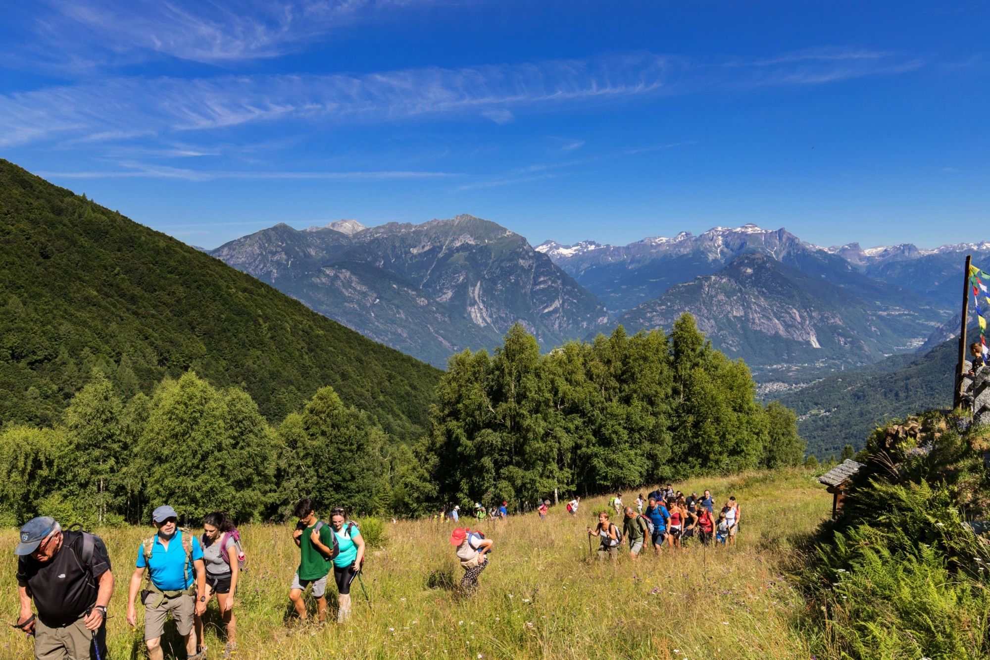
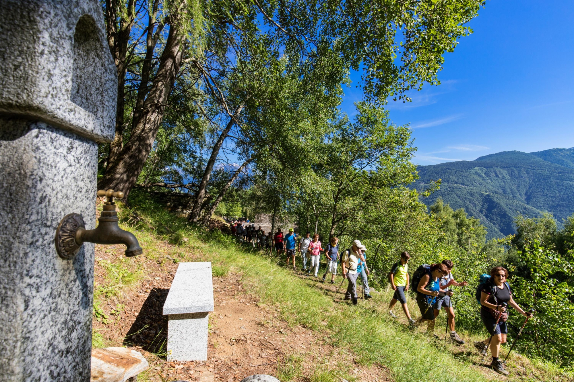
On the second day, return to Alpe Nava and continue on route A16 to reach Alpe Rina, where you’ll find the Alpe Menta camp used by Italian alpine troopers (Alpini). Via the characteristic Scala di Ragozzale steps carved into the rock, you reach the pass of the same name and the camp. The latter is the starting point for route P20, which leads to In La Piana, the silent heart of the Val Grande, where you can enjoy intimate contact with the most authentic nature. Be very careful in the section between the camp and the Mottac ridge, as the path is on a steep slope. Once you reach the ridge, leave path P20 and take path P20a which, almost flat, leads to the Passo di Basagrana pass. From here, you can enjoy a spectacular view over the peaks of Ossola and the Val Grande.
Descend along route A14 up to just above Alpe Campo and then follow route A14a until you reach the Parpinasca Refuge again.
The third day is dedicated to returning to Trontano: ascend via path A14a until you cross path A14 and then follow this down to Alpe Graglia, Alpe Briasca and the small stone village of Verigo.
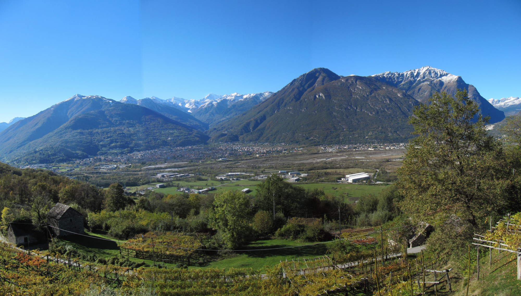
From the Vigezzina-Centovalli Railway station in this last village, you’ll reach the Chapel of Verigo by crossing the village. Then take route M00a in the direction of Trontano. This beautiful mule track allows you to cross vineyards and reach the characteristic mills of the Rio Graglia, which are beautifully preserved. It finally reaches Trontano, behind which stand the peaks of Andolla and Weissmies.

Useful info

Italian Alpine Club (CAI) site identification code

Sector A “Routes”– IA16

Useful info

Domodossola FS International Railway Station (from Bern and Milan).
Take the train along the Vigezzina-Centovalli Railway, getting off in Trontano.
Contact details: Municipality of Trontano
CAI contact details: Domodossola Section
Val Grande National Park
Accommodation: Parpinasca Refuge

Difficulty

Medium difficulty.
On the first day the route does not present any major difficulties, but watch out for the signage in the Drisioni / A16 fork stretch. On the second day, however, the route is challenging and you should be very careful on the exposed stretch between Alpe Ragozzale and Costa del Mottac. The last part of the route does not present any particular difficulties, it’s only the first part where you need to pay attention.

Lenght

1st day 9.5 km
2nd day 16.5 km
3rd day 8 km

Ascent / Descent

1st day ascent 1244 m / descent 564 m
2nd day ascent 1032 m
3rd day ascent 270 m / descent 950 m

Total duration

1st day 5 hrs
2nd day 6 hrs 20 min
3rd day 2 hrs 55 min

Recommended equipment

Hiking boots and mountain clothing

Signage

A16 – A16b – A16a – A14 – A14a – M00a

Best time of year

From June to October

Reference map(s)

Map no. 14 scale 1:25,000 of the Geo4Map/CAI
Digital maps on the following apps: ViewRanger – Avenza Maps

Historic, artistic and cultural value
Value of traditional and peasant life
Natural value
Ideal for
Couples
Everybody
You will discover
Nature
Sport
UNESCO
Guide to itineraries and useful info
Ideal for
Couples
Everybody
You will discover
Nature
Sport
UNESCO
Guide to itineraries and useful info
Choose your
mountain guide
IAT di Domodossola
Piazza Matteotti (inside the railway station)
28845 Domodossola (VB)
See map
Choose your
tour or nature guide

You might also be interested in...